Underground Utility Surveys
We offer robust utility mark-out and utility mapping surveys, providing comprehensive detection of buried services and you confidence in the survey results.
UTILITY DETECTION AND MAPPING SURVEYS
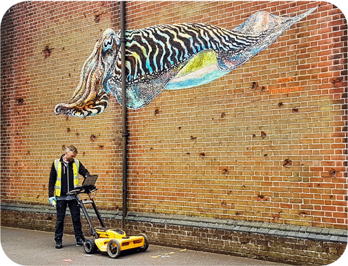
Our utility surveys combine the techniques of cover lifting, Radio Frequency/Electromagnetic Location (EML) and Ground Penetrating Radar (GPR) to detect and map metal pipes, plastic pipes, electricity cables, drainage systems, telecoms, CATV, traffic signalling and fibre optic cables.
To attain the highest levels of survey quality and continuity, each survey is managed by a Lead Surveyor, who oversees on-site operations, then produces the survey drawing before passing it through quality assurance.
If you need additional drainage information we offer manhole reports and the option of a CCTV drainage condition survey using the latest Wincan reporting software.
Mapped survey results are created in CAD, with all utility information accurately recorded on to a topographical survey plan and digital copies issued in DWG and PDF file formats.
RECENT UNDERGROUND UTILITY SURVEY PROJECTS
With over 30 years surveying experience we have three primary aims:
taking pride in our surveys
holding ourselves to the highest standards
responding to you and your needs
Quotations with clear and concise pricing, scope and methodology
Speed and efficiency, whether quoting or delivering your survey results
A proven reputation for delivering countless surveys on these core values, our repeat clients will confirm this
TO FIND OUT MORE
OR REQUEST A QUOTATION