Home
About Us
Services
Desktop Mapping
Underground Utility Surveys
PAS 128 Surveys
Ground Penetrating Radar Surveys
Topographical Surveys
Recent Projects
Contact Us
Home
About Us
Services
Desktop Mapping
Underground Utility Surveys
PAS 128 Surveys
Ground Penetrating Radar Surveys
Topographical Surveys
Recent Projects
Contact Us
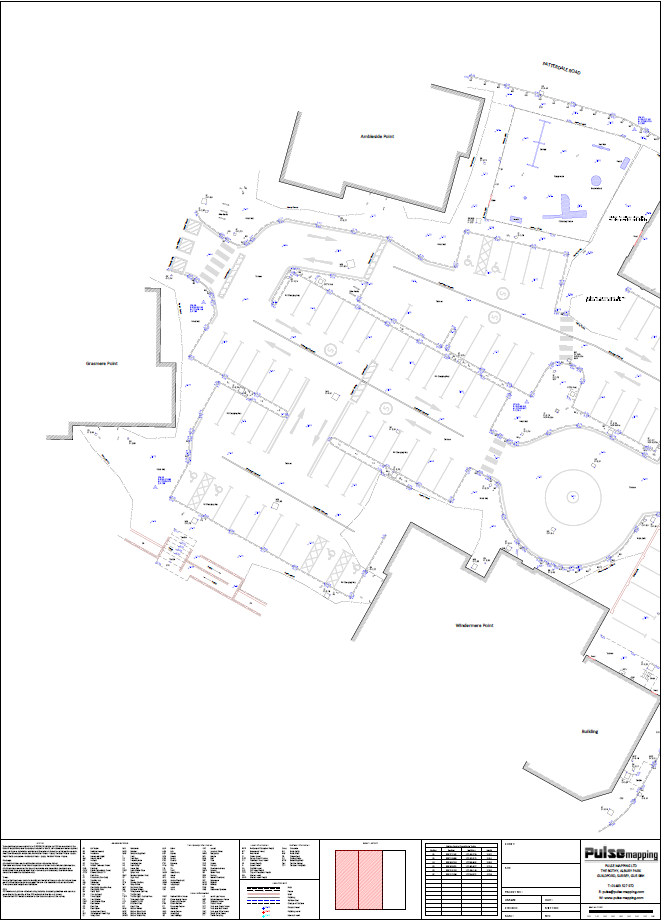
Topo Survey January 24
17194
portfolio_page-template-default,single,single-portfolio_page,postid-17194,bridge-core-3.1.3,qode-page-transition-enabled,ajax_fade,page_not_loaded,,qode-child-theme-ver-1.0.0,qode-theme-ver-30.4.2,qode-theme-bridge,disabled_footer_top,qode-portfolio-single-template-1,wpb-js-composer js-comp-ver-7.8,vc_responsive,elementor-default,elementor-kit-17460
Topo Survey January 24
Survey Results
CLICK HERE TO VIEW PDF
Date
January 19, 2024
Category
Topographical Survey
About This Project
Our client required a 2D topographical survey with OSGB36(15) survey control in order to provide accurate measured details for redevelopment of the area.